[ad_1]

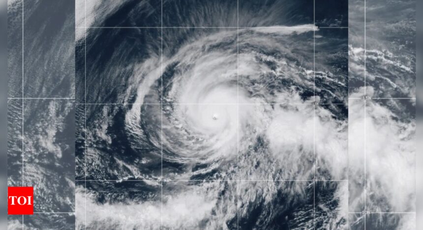
Hurricane Kristy intensified into a Category 5 storm on Thursday as it churned in the Pacific Ocean, with forecasters expecting it to gradually weaken over the coming days.
As of Thursday afternoon, Kristy was located 970 miles southwest of the southern tip of Baja California, Mexico, moving westward at 16 mph (26 kph) with sustained winds of 160 mph (260 kph), according to the National Hurricane Center (NHC).
As per USA Today, although Kristy poses no immediate threat to land, the NHC warned that swells generated by the storm are expected to impact parts of the Baja California peninsula’s west coast through the weekend, creating dangerous surf and rip current conditions.
First Category 5 storm in the Pacific without
Kristy made history as the first Pacific hurricane to reach Category 5 status without the influence of El Niño since Hurricane Celia in 2010.
Typically, El Niño conditions, which involve warmer waters and reduced wind shear in the eastern Pacific, contribute to stronger storm formation. However, Kristy defied this trend, further showcasing the unpredictability of the 2024 hurricane season.
The storm originated from Tropical Storm Nadine, which made landfall in Belize earlier in October. After Nadine dissipated, its tropical energy moved westward across Mexico and fuelled Kristy’s rapid intensification in the Pacific basin.
Kristy joins Beryl and Milton as the third Category 5 storm of 2024, marking an active hurricane season.
Expected weakening ahead
Kristy is forecast to begin weakening on Friday, with the hurricane expected to lose its Category 5 status as it continues to drift over open waters. The NHC anticipates the storm will downgrade to a tropical depression by the weekend. However, fluctuations in intensity are still possible through Thursday night.
The storm is not expected to impact any landmass directly, but its powerful winds and swells will likely create hazardous conditions along the west coast of the Baja California peninsula.
As the hurricane season in the Eastern Pacific continues until November 30, forecasters are also monitoring the potential development of La Niña, which could affect future storm activity by increasing wind shear in the Pacific and making it harder for storms to form.
[ad_2]
Source link


